- 469 Point Breeze Rd. Flemington, NJ 08822
Specialized Support Services
Aqua Survey can support your project with a selection of vessels to charter for your needs. Our remedial site investigation team is available for site visits and characterization. We have specialty tools to assist with cultural resources location and recovery that are also perfect for assisting law enforcement in an underwater crime scene investigation.
Specialized Support Services
Aqua Survey can support your project with a selection of vessels to charter for your needs. Our remedial site investigation team is available for site visits and characterization.
We have specialty tools to assist with cultural resources location and recovery that are also perfect for assisting law enforcement in an underwater crime scene investigation.
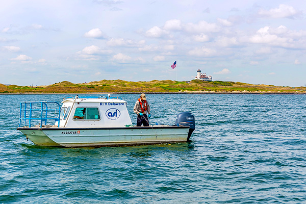
Aqua Survey owns and operates an array of vessels and platforms that can be utilized on various projects and diverse waterbodies.
The following Aqua Survey vessel types are available:
• Highly maneuverable jet boats
• Commercial grade catamaran self-propelled pontoon vessels
• Mono-hulled survey vessels
• Commercial grade pontoon platforms
• Inflatable self-propelled pontoons (for work in remote areas)
• Mono-hulled open support vessels
• Tracked amphibious vehicles
Vessel Charter
Aqua Survey owns and operates a fleet of over 20 research / survey vessels customized to support markout, environmental and geotechnical field services. The vessels range from a 12-foot amphibious vehicle to a 32-foot folding-wing pontoon boat.
Our vessels are commonly used for site tours, dive support, drilling, monitoring equipment installation, fisheries studies, and also as filming platforms by the motion picture industry.
All vessels are capable of operating in shallow-draft areas by United States Coast Guard-licensed captains and OSHA HAZWOPER 40-hour trained crew members.
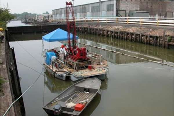
Remedial Investigation
The methodology that most environmental cleanup programs have established for characterizing the nature and extent of risks posed by contaminated sites and for evaluating potential remedial options.
The Remedial Investigation serves as the mechanism for collecting data to characterize site conditions; determine the nature of the contaminants and assess risk to human health and the environment.
Aqua Survey investigates many submerged and partially submerged remediation zones to give our clients a better understanding of the current conditions of their site.
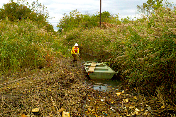
We perform the following services on remedial sites in submerged and partially submerged zones:
• On-water site visits are performed in the appropriate support vessel to familiarize the team with the project. HD video of the site visit can be produced to aid discussion and familiarize the team with site conditions.
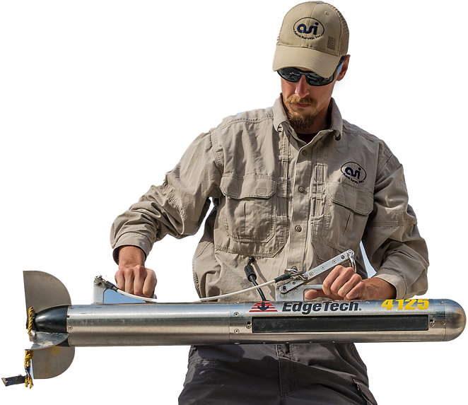
• Geophysical surveys such as hydrographic/bathymetric, side scan sonar, sub-bottom profiling, magnetometry, electromagnetic metal detection, bottom classification and current profiling can be performed to physically define the site.
• Sediment characteristics are obtained through sediment grab sampling, sediment coring and sediment profile imaging.
• Water quality is determined by water sampling, water quality monitoring and semi-permeable membrane devices.
In order to physically, chemically or biologically define a site, fish collection, taxonomy of fish and invertebrates and a benthic survey are performed.
• Water column toxicity tests, sediment toxicity tests and sediment bioaccumulation potential studies are utilized to profile a site’s acute and chronic toxicity and the potential for organisms exposed to the environment to bioaccumulation contaminants.
–
Cultural Resources
Aqua Survey is here to support marine archeological projects including historic preservation, marine archaeology, landscape architecture and the search for lost treasure.
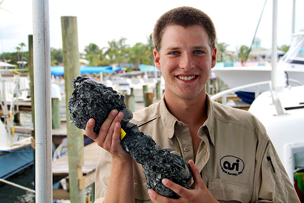
Aqua Survey is staffed with Scientists and Marine Professionals
Our fleet of vessels and vast array of geophysical instruments support the detection, characterization and precision mapping of cultural resources. Cultural resources studies are performed to locate and identify submerged artifacts, to investigate circumstances causing the resources to be submerged, to locate resources that need to be avoided during construction and to assist both not-for-profit and for-profit marine archeological firms.
The following services are provided to support these studies:
• Geophysical studies with side scan sonar, sub-bottom profiling, magnetometer studies, electromagnetic detection studies and bathymetric surveys
• Sediment vibracoring for C14 radiocarbon dating and grain size analysis
• Electromagnetic detection of buried metallic artifacts with benthic sled and diver maneuvered systems
To find a needle in a haystack you must have the right plan of attack, equipment and training.
Clients typically have general knowledge where a wreck or debris trail is located. Occasionally, the wreck or artifacts, like bombs (targets of interest) are proud of the bottom, but more often they are buried out of sight. When searching for a wreck, Aqua Survey designs a survey approach to minimize false positives and false negatives. Our trained professionals know how to plan and perform efficient surveys, process data critically and to reacquire, investigate and recover targets rapidly.
Underwater Crime Scene Investigation
Searching for Key Evidence?
Aqua Survey locates high-risk and high-value metallic objects underwater, such as firearms and knives that have gone missing and may be deeply embedded within the sediment.
Finding things that have gone missing underwater is Aqua Survey’s specialty. Aqua Survey uses the same equipment in criminal investigations that they use in locating submerged and sediment buried unexploded ordnance. The Department of Defense trusts us to find live bombs. You can trust us on your case.

Side Scan Sonar & ROV Video
If a pistol has just been tossed into a water body and there isn’t much wave action or the sediment isn’t too soft, it’s possible to use conventional investigation methods such as side scan sonar or an ROV’s video camera to find the evidence. It’s a scientific fact that knives, handguns and other metal evidence will settle through sand and mud because of their greater density. Due to water currents, crime scene evidence, just like your feet at the edge of the ocean, disappears into the bottom in minutes or hours, usually not days.
Magnetometer & Hand Held Detectors
If wave and current action cause the pistol to bury itself into the bottom, a magnetometer can sometimes be used to locate it, providing there isn’t metal debris clutter or major metal infrastructure such as a bridge in the area. If the investigation area is small, a handheld metal detector might work to find shallow buried metallic objects. However, environmental obstructions coupled with poor detection ranges can often render handheld metal detectors ineffective and even useless.
Electro-Magnetic Detectors
The use of EM detectors to locate metallic crime scene evidence overcomes many obstacles. EM coils look directly below the coil thus eliminating issues of working close to bridgeworks and other metal structures. Aqua Survey’s EM coils are 1 or 2.5 meters (3 to 8 feet) wide and can survey a large area quickly. They can detect a handgun buried several feet below the sediment surface. By using survey-grade precision-positioning electronics, survey data can be processed and a target investigation list compiled for the crime scene investigators to quickly reacquire and intrusively investigate each pinpointed target.
Survey, Sampling, & toxicity
experts since 1975
Aqua Survey, Inc. has proven and refined methods to get your job done right. We’re also innovators that don’t shy away from a challenge. Contact us today for a free consultation on your project.